This site uses cookies to improve your experience. To help us insure we adhere to various privacy regulations, please select your country/region of residence. If you do not select a country, we will assume you are from the United States. Select your Cookie Settings or view our Privacy Policy and Terms of Use.
Cookie Settings
Cookies and similar technologies are used on this website for proper function of the website, for tracking performance analytics and for marketing purposes. We and some of our third-party providers may use cookie data for various purposes. Please review the cookie settings below and choose your preference.
Used for the proper function of the website
Used for monitoring website traffic and interactions
Cookie Settings
Cookies and similar technologies are used on this website for proper function of the website, for tracking performance analytics and for marketing purposes. We and some of our third-party providers may use cookie data for various purposes. Please review the cookie settings below and choose your preference.
Strictly Necessary: Used for the proper function of the website
Performance/Analytics: Used for monitoring website traffic and interactions
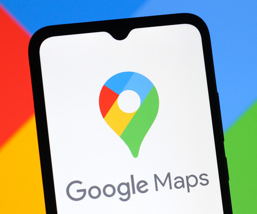
The Google Maps Timeline has long been a useful though slightly uncomfortable feature that maintains a complete record of everywhere your phone goes (and probably you with it). In an email sent out over the weekend, Google confirmed what many already feared: Maps has accidentally deleted Timeline data on countless devices.
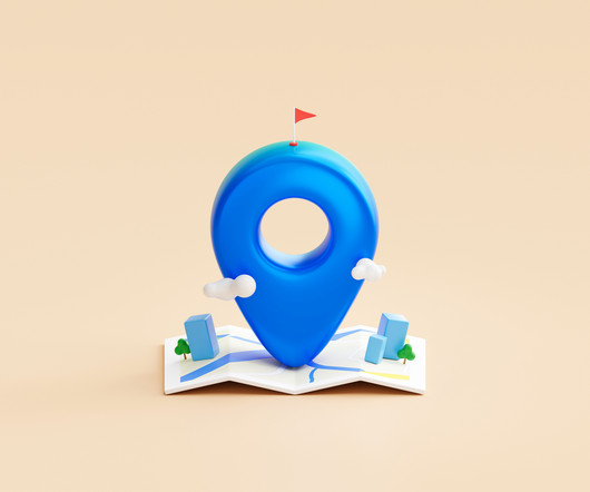
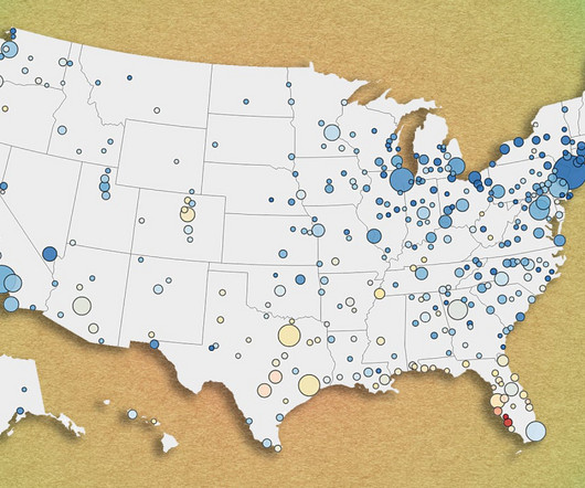
Maps can be a great visualization tool and an engaging way for supporters to connect with the causes they care about. Here are five ways nonprofits use maps to support their missions.
Yes — the matrix map. It is very tempting — and common — to pursue a variety of programs that promise short-term financial return and satisfy the wants and desires of the staff and board. So, is there a tool that can help you create a more streamlined and focused approach for your nonprofit?
Apple plans to start using images it collects for Maps to train its AI models. The company originally released the feature alongside its 2019 revamp of Apple Maps. The company originally released the feature alongside its 2019 revamp of Apple Maps. Look Around is Apple's answer to Google Street View.
Uncover the Benefits of Maps for Nonprofit Fundraising. Maps are one of the most powerful tools available to nonprofits when it comes to creating compelling visual stories. Maps can be used to illustrate the work of a nonprofit, the areas they serve, and the impact of their fundraising efforts.
Instead of letting those images become lost in your camera roll, Google will let you feed them into Maps. The new screenshot list feature will let you add those images to Maps, where Gemini will scan them to identify locations. This feature is opt-in, and the AI doesn't appear to detect locations with image recognition.
Salesforce Maps may be the perfect solution for your association! With Salesforce Maps, your organization can identify trends, patterns, and opportunities within your data, mapped geographically. What is Salesforce Maps? Are you looking for a new way to view and analyze your data in a geographical context?
Donor Journey Mapping is a process for helping organizations understand their current donor experience, identify opportunities to improve, and implement a plan to enhance it. They did their Donor Journey Mapping Homework by: Defining the audience: Donors who had the potential to make a $1k gift. Need help understanding your donors?
The map above shows the year-over-year change in metro-area home prices from December 2023 to December 2024. The map below shows how metro-area home prices at the end of 2024 compare to that respective markets peak in 2022. Click here to view an interactive version of the map below. Springfield, Ohio: +11.8% Ocala, Florida: -1.9%
The road to implementing new technology can be a long one, but your organization can smoo th the way with business process mapping. Read our blog to learn everything you need to know about b usiness process mapping and prepare your association for implementation success. What is business process mapping?
Google is updating its mapping platforms with new generative AI capabilities based on its Gemini AI model. The updates, rolling out across Google Maps, Google Earth, and Waze, aim to enhance these services and solve complex geospatial problems. Read Entire Article
A beta version of Apple Maps is now available for web browsers, opening the Google Maps alternative to non-Apple platforms. The preview lacks some of the native app's features, but updates are planned in the coming months. Read Entire Article
Just as […] The post The Da Vinci Code of Data: Mastering The Data Science Mind Map appeared first on MachineLearningMastery.com. The intersection of these domains is where true data alchemy happens – transforming and interpreting data to tell compelling stories that drive decision-making and knowledge discovery.
Combined with a detailed map of Florida's roads, along with their speed limits, they could determine when a given driver was speeding. They also obtained Florida police records of any accidents and cross-referenced their locations to any vehicle that experienced a sudden stop in that spot at the same time.
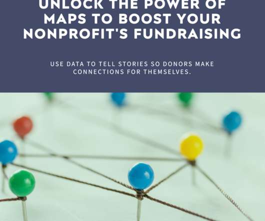
Discover how mapping capabilities can unlock valuable insights into donor behavior and visualize the impact of your organization's initiatives to inspire donor support.
Formally known as the Remix Jam map pack, the bundle contains 30 remixed maps that borrow heavily from fan favorites like Unreal Tournament, GoldenEye 007, Halo, and even Mario Kart 64 (yes, apparently Rainbow Road makes for a good Quake map). They were all made within a three-week community level design event.
Map the donor lifecycle: Visualize the stages donors go through from initial awareness to becoming loyal supporters. Automate journeys: Create automated email sequences triggered by donor actions, such as welcome series for new donors, re-engagement campaigns for lapsed donors, or thank-you messages with impact reports.
If you’ve never done so, developing donor journeys (also known as donor journey mapping) can feel like quite an undertaking. Donor journey mapping can be as complex or as simple as you like—as with all new things, it’s best to start simple and grow from there. Donor Journey Mapping Basic Steps. How do I segment my list?
Introducing the Mission Action Pack (MAP) To further enhance the accessibility and affordability of HubSpot for nonprofits, we are proud to introduce Mission Action Pack (MAP). Want to see how the Mission Action Pack (MAP) could work for your organization? Learn more at benevolent.tech and schedule a personal demo.
According to SFGate, Shelby Easler, her brother Austin, and their partners were driving back to Los Angeles from Las Vegas on November 19, using Google Maps for navigation. The group reportedly decided to take an alternative route off Interstate 15 after the app informed them that a dust storm was. Read Entire Article
The telescope is equipped with a 600-megapixel camera tasked with mapping more than a third of the sky – out to 10 billion light-years – over the coming years. Euclid launched from Florida's Cape Canaveral on July 1, 2023, and sent back its first test photos just one month later. Read Entire Article
This ranges from familiar products like Google Maps to more cutting-edge technologies. If a worker has impaired wayfinding, mapping apps can be tailored to working environments and live location data can be used to guide staff around complicated sites. Many of us would struggle without our online calendars and maps.
Google says that its update to Google Maps will give users more control over their location data. The navigation app's Location History feature, which is turned off by default, stores your activity in the cloud, showing where you've recently been. The idea is to help people remember the places they've. Read Entire Article
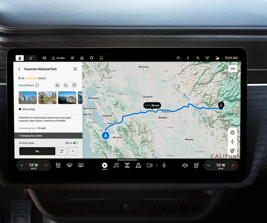
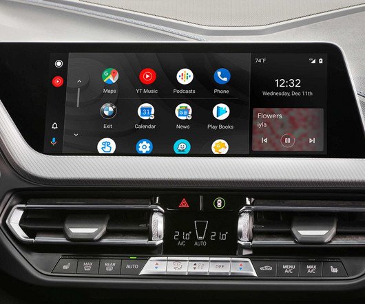
Users of Android Auto have noticed the ability to view 3D buildings in Google Maps during in-car navigation. While the smartphone app has offered a close-up 3D view for some time, testing suggests that Google plans to extend this feature to Android Auto and Apple CarPlay soon. Read Entire Article
According to a new paper published in the journal Nature, astronomers have mapped the 3D structure of the layered atmosphere of one such ultra-hot Jupiter-size exoplanet, revealing powerful winds that create intricate weather patterns across that atmosphere.
Join Cherian Koshy, CFRE, and Kelly Ramage, DonorPerfect Learning and Development Manager, for two free webinars that will help you map out personalized and scalable donor journeys. Put simply, its the way the relationship between a donor and a nonprofit shifts and evolves over time.
Join Cherian Koshy, CFRE, and Kelly Ramage, DonorPerfect Learning and Development Manager, for two free webinars that will help you map out personalized and scalable donor journeys. Put simply, its the way the relationship between a donor and a nonprofit shifts and evolves over time.
By mapping out possible pathways for these changing relationships, youll create seamless donor experiences that inspire generosity and lifelong engagement. What is a donor journey? Put simply, its the way the relationship between a donor and a nonprofit shifts and evolves over time. Learn more from Cherian Koshy and DonorPerfect!
It has deployed a small fleet of retrofitted test vehicles throughout the city for the purposes of mapping and data-collection. These have been equipped with Zooxs self-driving tech and will gather mapping data. Amazons autonomous vehicle company Zoox has begun testing its robotaxis in Los Angeles. Lidar, camera, action!
Google Maps is adding functionality that'll help folks deal with weather-related road issues while driving. This week, Android Police spotted that Google Maps added new report-types — flooded road, low visibility, and unplowed road — aimed at helping drivers navigate or avoid dangerous weather problems.
Ideally, when searching for a business like a restaurant in a mapping application, you would want the most relevant results whether based on relevance or proximity rather than those that simply pay to appear at the top of the list. Read Entire Article
Using GPS technology, organizations are in the driver's seat with access to live maps, driver scorecards, a fleet management dashboard with vehicle health, and much more! PHLYTRAC gives dynamic insights into driver behavior, vehicle stats, and more to help organizations lower the risk of driver-related accidents.
Tesla owners are seeing inflated odometer readings 20-30% higher than driving the same route with a different vehicle or compared to Google Maps trip distance. EV forums and related subreddits , however, are filled with odometer complaints involving the company. Hey @NHTSAgov you up?
While fund development planning requires a lot of time, energy, and resources, it’s critical for organizational success as it outlays a road map for your funding endeavors.
Using GPS technology, organizations are in the driver's seat with access to live maps, driver scorecards, a fleet management dashboard with vehicle health, and much more! PHLYTRAC gives dynamic insights into driver behavior, vehicle stats, and more to help organizations lower the risk of driver-related accidents.
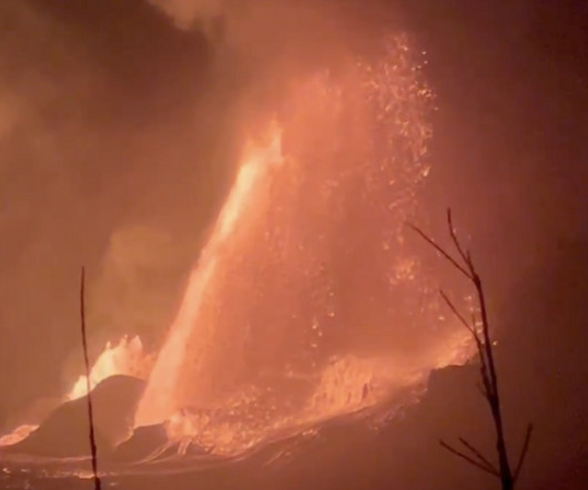
Tweet may have been deleted A map showing the location of Hawaii's Kilauea and its past lava flows. SEE ALSO: What will happen when the next supervolcano erupts, according to NASA "This clip shows a view of 600-foot-high lava fountains from episode 11 of the ongoing eruption of Kīlauea," the USGS said. The episode started at 6:26 p.m.
Using GPS technology, organizations are in the driver's seat with access to live maps, driver scorecards, a fleet management dashboard with vehicle health, and much more! PHLYTRAC gives dynamic insights into driver behavior, vehicle stats, and more to help organizations lower the risk of driver-related accidents.
The news comes a week after Tesla started providing the limited-time trial of its advanced driver assistance system in China from March 17 to April 16 to local users, provided they have a car with compatible hardware and the newest version of navigation maps. [ IT Home , in Chinese]
Math and computer science researchers have long known that some questions are fundamentally unanswerable. Now physicists are exploring how physical systems put hard limits on what we can predict.
In 2023, Garmin launched Outdoor Maps Plus , charging $50 for access to more advanced mapping features. Access to Garmin Connect data has been free compared to competitors like Whoop, Fitbit, and Oura, which require paid subscriptions or offer a premium tier.
We organize all of the trending information in your field so you don't have to. Join 12,000+ users and stay up to date on the latest articles your peers are reading.
You know about us, now we want to get to know you!
Let's personalize your content
Let's get even more personalized
We recognize your account from another site in our network, please click 'Send Email' below to continue with verifying your account and setting a password.


Let's personalize your content