This site uses cookies to improve your experience. To help us insure we adhere to various privacy regulations, please select your country/region of residence. If you do not select a country, we will assume you are from the United States. Select your Cookie Settings or view our Privacy Policy and Terms of Use.
Cookie Settings
Cookies and similar technologies are used on this website for proper function of the website, for tracking performance analytics and for marketing purposes. We and some of our third-party providers may use cookie data for various purposes. Please review the cookie settings below and choose your preference.
Used for the proper function of the website
Used for monitoring website traffic and interactions
Cookie Settings
Cookies and similar technologies are used on this website for proper function of the website, for tracking performance analytics and for marketing purposes. We and some of our third-party providers may use cookie data for various purposes. Please review the cookie settings below and choose your preference.
Strictly Necessary: Used for the proper function of the website
Performance/Analytics: Used for monitoring website traffic and interactions
Whether we look at mapping tools, fundraising, or missing person systems, the social media response to the January earthquakes in Haiti all leverage the powerful technology we can hold in our hands: our mobile phones. Those not in Haiti can also use the application as it aggregates news and actions to take. How can we do that?
Oxfam in Haiti – Google Maps – This is a great example of how you can use a tool like Google Maps to tell a story and provide easy access to information – great job Oxfam! "Oxfam "Oxfam is responding to the biggest earthquake for 200 years in Haiti. "You've got data.
" » Your Mobile Giving by State – Wendy Harman at the American Red Cross has posted a map and data about the funds donated via texting "Haiti" to 90999 to support the victims in the Haiti earthquake crisis. Submissions close January 22, 2010."
On January 12, 2010, I didn't personally experience the major earthquake that hit Haiti, but I was forever changed by it. In the midst of the viral Text HAITI to 90999 message, we saw the emergence of what we're calling emergency social data, or #crisisdata. Melissa Eliott was heavily involved in the Haiti relief effort as a volunteer.
The magnitude of the destruction and the heart-breaking images have remained with us as organizations, governments, and private individuals have struggled beyond the immediate aftermath to effect long-term change and economic impact within Haiti.
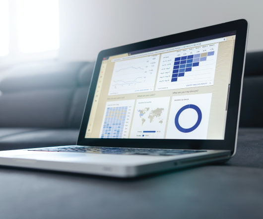
Geographic information systems (GIS) and online mapping applications continue to become more powerful and easier to use every year. Mapping applications that used to require sophisticated software and time-intensive training to create can now be completed in a matter of minutes with user-friendly tools. Jim Craner , MapTogether.
Since the earthquake in Haiti, we've seen an explosion in interest for all things mobile. Donations via text messages , tweeting real-time updates , mapping need and resources : all examples of stories that captured our sector's attention and got people talking about mobile. The time for mobile is clearly now.
HaitiAidMap from InterAction (Note: This is a weekly round-up of NTEN members doing and sharing their nptech awesome. Tag your own news with "nten member" or "nptech" to help us find your awesome online, or contact Annaliese with your updates.) . yesterday, so I think it qualifies for nptech awesome online.
I’ll review some new green IT developments like how nonprofit solar electricity is thriving in Haiti. Green IT: Glad Tidings from Haiti. We’re used to hearing nothing but bad news from Haiti since it was hit by a succession of catastrophic events since 2010. Sanebox starts at $2 per month per user.
Geographic information systems (GIS) and online mapping applications continue to become more powerful and easier to use every year. Mapping applications that used to require sophisticated software and time-intensive training to create can now be completed in a matter of minutes with user-friendly tools. Jim Craner, MapTogether.
CrisisCamps took off after the earthquake in Haiti. These included an English-Creole dictionary phone app, tools for tagging photographs of displaced people, texting tools that could be coordinated with the Ushahidi text alert system, and several tagging and updating efforts of satellite imagery and maps.
CrisisCamps took off after the earthquake in Haiti. These included an English-Creole dictionary phone app, tools for tagging photographs of displaced people, texting tools that could be coordinated with the Ushahidi text alert system, and several tagging and updating efforts of satellite imagery and maps.
2010 was also a good year for maps and data visualization, from the true size of Africa and the relief efforts in Haiti to the amount of data Americans consume and the relative size of all the social media spaces. And you definitely need a custom landing tab. But should your ED be the one figuring it out ?
2010 was also a good year for maps and data visualization, from the true size of Africa and the relief efforts in Haiti to the amount of data Americans consume and the relative size of all the social media spaces. And you definitely need a custom landing tab. But should your ED be the one figuring it out ?
Conservation mapping and 3D imaging. A good place to look first is Andreas Raptopoulos' TED Talk about Matternet drones delivering medicines, food, and other high-value goods for disaster relief like they did in Haiti. How Are Drones Being Used for Good? Assessing disaster-stricken areas. Tracking storms. Search and rescue.
I've had some posts in pipeline following up on social media metrics and the Chase Community Giving Contest second phase, but wanted to share these two stories from Haiti from on the ground and a bird's eye view. I'm going back to Haiti in the next few days and need help to give hands-on help to our kids and the townspeople.
There are lots of alternative gift giving opportunities too, take for example Save the Children gift catalog that lets you and your children explore a map of the world and imagine how simple gifts make a difference. Slides are available in the NpTech group in Slideshare. There's a good case study of LinkedIn.
Jorge Luis Borges points out that a 1:1 scale map is useless. Daum Communication , a leading internet services provider in Korea offers a map service with a streetview option, much like Google Maps does in the States. But what’s the point? Aren’t we doing just that when we don’t filter to good from the mundane?
We organize all of the trending information in your field so you don't have to. Join 12,000+ users and stay up to date on the latest articles your peers are reading.
You know about us, now we want to get to know you!
Let's personalize your content
Let's get even more personalized
We recognize your account from another site in our network, please click 'Send Email' below to continue with verifying your account and setting a password.


Let's personalize your content